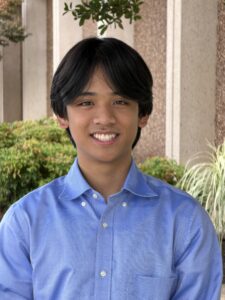
Hello! My name is Jeremiah Arceo. I am a Good Neighbor Data Analyst Intern for the Good Neighbors Program (GNP) at Shenandoah National Park Trust for Summer 2026. I am a Computer Science major with a minor in Data Science at UVA, and I enjoy using data to answer complex questions and support meaningful decisions that help organizations and the people they’re working with. That interest is what drew me to this opportunity for GNP where I can apply analytical skills towards conservation objectives by the Trust.
The Good Neighbors Program, managed by Elizabeth (Beth) Mizell, is one of the programs by the Trust that helps build and maintain relationships with thousands of landowners bordering the Park to help protect those lands. By working closely with these partners, GNP supports the Trust’s goals by protecting the Park’s ecological integrity while strengthening connections with surrounding communities.
As an intern, I was able to support the Good Neighbors Program using geospatial analysis and spatial data management. To summarize my general workflow, I approached projects by identifying a program-specific research question, I identified and prepared spatial datasets relevant to answering the question, I used ArcGIS and other GIS analysis tools and technologies to uncover important patterns, and then I translated those findings into interactive visualizations, analysis reports, and GIS resources that guide and inform planning and stakeholder discussions.
Throughout this internship, I was able to enhance my skills with geospatial analysis, GIS, spatial data management, data pipelining, and data visualization. Equally important, I was able to strengthen my communication skills by translating technical analyses into clear and engaging resources that can be understood by the GNP’s committee members, partners, and stakeholders with a variety of backgrounds. One of the most rewarding aspects of this experience was seeing firsthand how the projects I developed guided and assisted conversations Beth had with the people she’s working with.
A fun activity I did during my internship was during a staff bonding day where we visited the Shenandoah National Park on a sunny and breezy day. I was also fortunate enough to meet with Craig Fergus, GIS Lab Manager at the Smithsonian, along with National Park Service leaders who gave me valuable perspectives on combining data analysis and geospatial sciences to support conservation and decision-making.
Lastly, I was able to present to the office what I did during my internship and showcase the projects I completed in my Intern Presentation near the end of my internship.
As my internship comes to an end, I am grateful for the opportunities and experiences the program gave me to explore my skills with technology, data analysis, stakeholder communication, and conservation, while also contributing these skills to benefit the program.
I want to give a special thanks to Beth Mizell for her close mentorship and guidance throughout this experience. Working alongside Beth and the welcoming staff here at the Trust has been such an incredible experience. This internship has reinforced my interest in applying data and technology towards meaningful and real-world challenges. I look forward to building these skills with future academic and career experiences.